
Do GPS hiking Apps signal the end of paper maps and compass ?
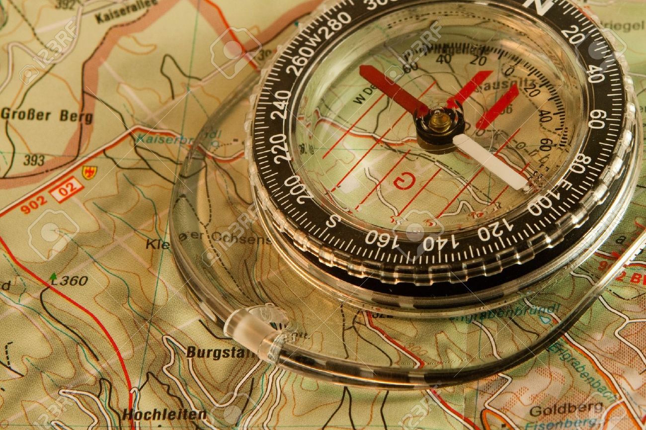
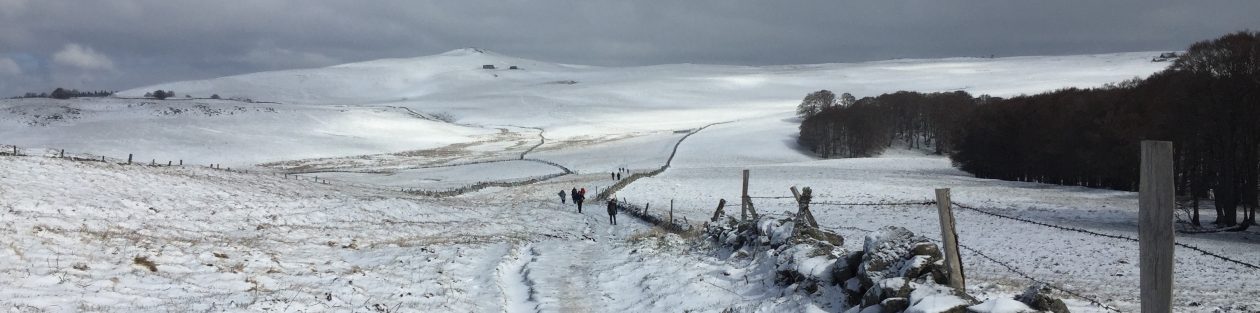
Apart walkers who simply follow a group without asking any questions except about lunch time, most hikers are still trying to find out where they are, what direction to take to achieve their goal or how to decide a plane B if something goes wrong, estimate the time remaining to walk. For a long time, using topographic paper maps, which are tourism (Michelin, IGN …) or those called of Staff, cadastral, etc. The compass always part of the essential accessory to the use of the topographic map. The scale typically used rando is 1: 25.000e, that is to say 1 cm = 250 m. This scale provides sufficient accuracy to follow a route on foot. Topographic maps contain a wealth of useful information to guidance: GR, PR, GPR not defined the FFRP ( Federation Française de Randonnée Pédestre), roads, contour lines defining the terrain, rivers, various buildings (water towers, churches, viaducts …) and the numbers of the parcels of land in the forest helpful. We must therefore learn to read the cards. Nothing complicated, and most clubs and hiking associations offer orientation courses. We must therefore learn to read the cards.
Advantages and weaknesses of paper maps: reliable support, no down, no energy. However, the update is done about every 5 years (eg IGN). Several cards are required for hikes over several days (weight and cost). The new cards called « compatible GPS » (Reference military UTM grid) make it easy to see the position read from a GPS (without base map) on the map and thus determine its position. Finally, despite the efforts of publishers, they remain fragile and poorly resistant to weathering. The use of the card holder is recommended here. Whatever the cards will always remain the most reliable backpacker guidance tool.

The new GPS smartphone: starting in 2018-19 an accuracy of 35 cm and less greedy
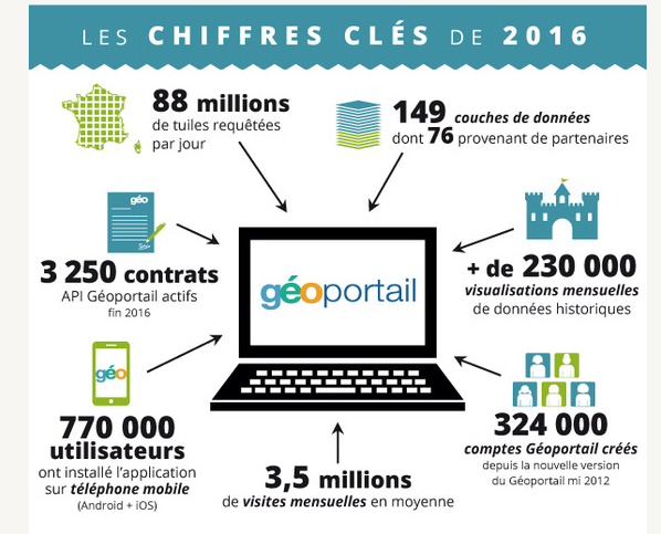
Almost all of the touch screen trade models is equipped with a GPS chip. And good news, the company Broadcom offer from a 2018 chip with an accuracy of 35 cm instead of 5 m now on Android devices. Consumption should also be reduced by 50%. Continued … To navigate with their smartphone hikers will download an application from the Apple Store (iOS) or Google Play (Android). Remember, Google Maps does not offer this possibility and more this app requires an internet connection (3G, 4G …). All applications are designed to load map of the funds for hiking, usually 1: 25.000e. Where do these cards? The most successful applications use the flow Geoportail. The site aims to facilitate access to geographic information reference, that is to say public information and official sources in the country. This tool allows for reliable and complete data being updated constantly. It includes digital geographic data IGN (aerial photographs, on any scale maps, representations of buildings and cadastral parcels, hydrography, altitude, networks, administrative boundaries, place names …). More than 1 500 applications and use the Geoportail data stream, so those rides that you find below. touring the App not differ wealth of their duties. The most important is the possibility to work « offline ». The idea is to store the base map by downloading the Wifi before hiking. GPS chips being particularly greedy, and this feature saves battery. App also offer to store your current track or hiking route that you have prepared at home on your Mac or PC, or download those of other walkers. (VisuGpx, Openrunner, Visorando …). On some system to « tag » allows your loved ones to locate you on a hike. Openrunner, Visorando …). On some system to « tag » allows your loved ones to locate you on a hike. Openrunner, Visorando …). On some system to « tag » allows your loved ones to locate you on a hike.
The use of digital mapping data of course has a cost. These App offer free trial periods a week and charge downloads or by geographical unit (eg a region) or monthly or annual subscription, and with various feature options – from 14 to 30 euros per year . Some like Iphigenia (thus IGN) have entered into partnerships with foreign geographic institutes (including Spain). That said the famous portal OpenStreetMap launches a community mapping free of charge. The accuracy of this offer remains somewhat random, just like loading files. These applications are also used on tablets that have a GPS chip.
Tips for hiking GPS users on smartphones.
1- Attention using a smartphone App riding on is more complex than it seems and will never replace paper map and compass in terms of reliability. But since you have in the bag, so use a dedicated App.
2- Prefer an app running « out Login ». (The 4G network)
3-Download faster maps home wifi.
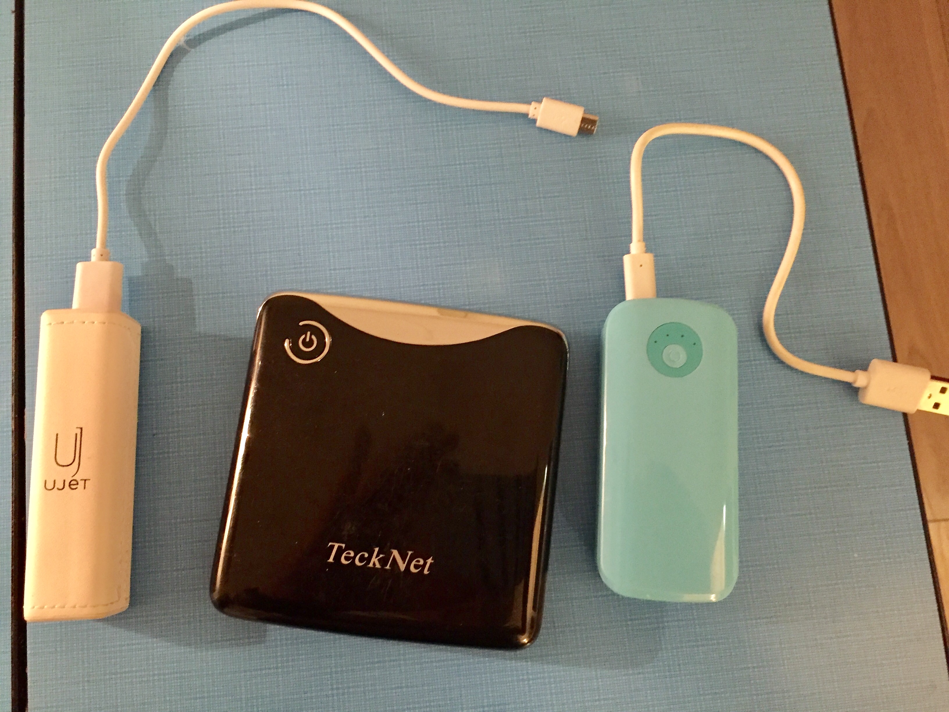
4- Provide an external backup battery (of 2200-4400 mah).
5- As a group touring, do not contradict the guide and the paper map out your smartphone all the time fields. Wait until he asks you!
6- No! Google Maps is not an application for hiking, but it helps out to locate.
7- Few smartphones are waterproof. Caution in the rain, protect your device from a special shell or mini freezer bag where you will vacuum with a straw. This works very well.
8- tablet side, find your own balance between comfort, weight and consumption. A 10-inch screen seems to be the maximum size.
A selection of hiking GPS App (Ios and Android to walk in France and Europe)
(Some of them provide english version)
 Sity Trail
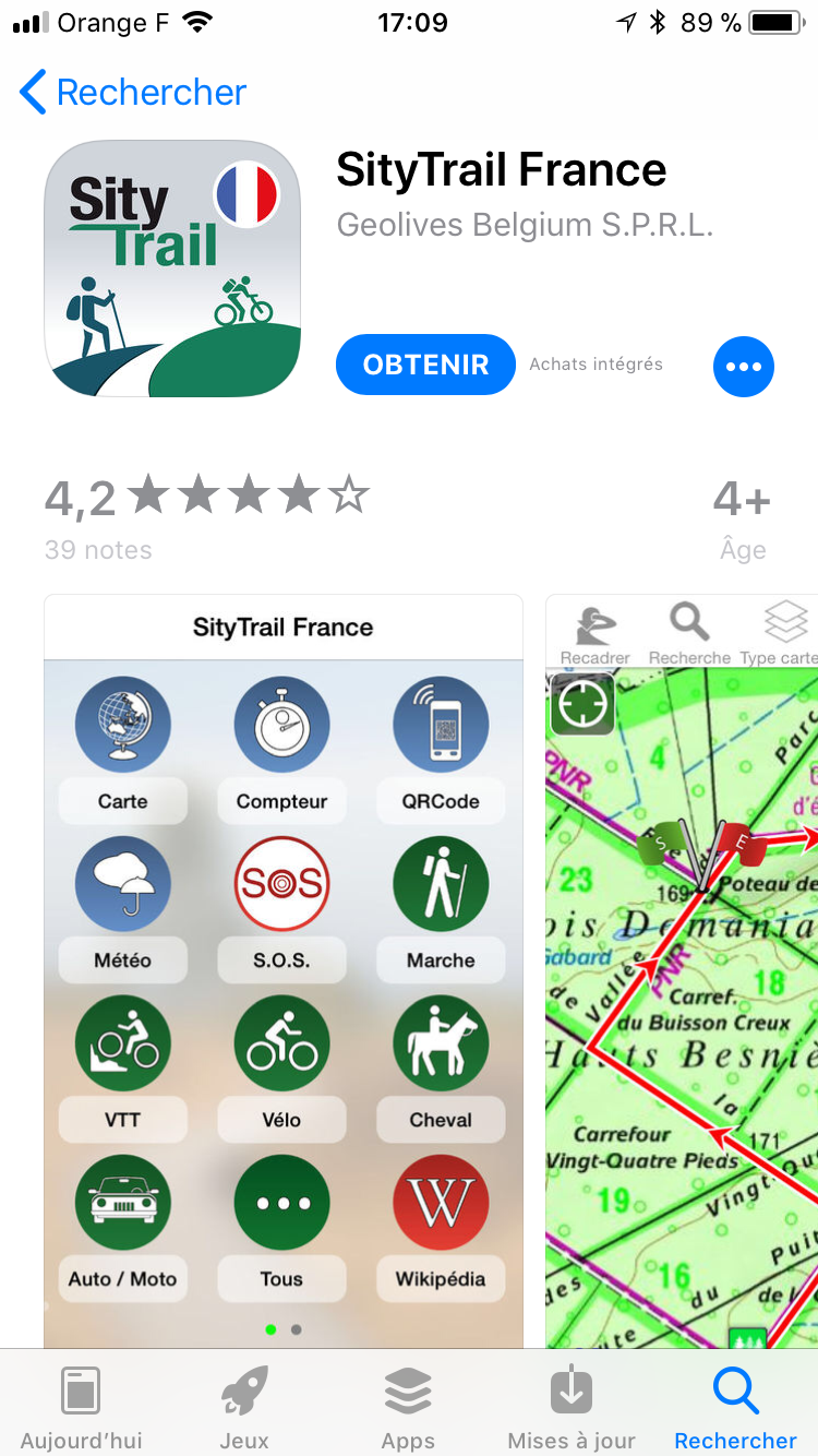
A trial week and 24.99 € / year or 11.99 € / month all inclusive. Comprehensive and intuitive, this application serves real basic GPS. Combined, it can be suitable for all forms of hiking, walking, AA horseback or mountain bike
Access to IGN mapping data via Geoportal: The set of topographic maps, aerial photos and cadastral parcels IGN France (Metropolitan France, Corsica and overseas territories) GR and PR FFR represented: GR and PR the French Hiking Federation. Ability to search the name of localities.
Maps available in Offline Mode: ability to download map areas of France with a radius of 5 to 50 kilometers ability to download maps for several randonnées.Limite maximum of downloaded maps: 10000 km²
Access to hiking users and tourist organizations: ability to search for trails by activity type around your position from a selection of journeys made by travel agencies and users of the application.
Registration hikes: visualization in 2D and 3D editing in Guide Editor, ability to share your rides with other users. – Import and export GPX files.
Customization with many available values (altitude, distance, average speed …) and ability to view directly on the map, ability to orientate the map in driving direction / compass. (Cape / Azimuth) -Service SOS to send by email or SMS your GPS position -Access to useful places (lodging, restaurants, attractions, …), to Wikipedia articles and the weather forecast – Ability to create markers on the map (thanks GPS, by coordinates – Geocaching, …) – Possibility of access and printing of cards via computer.
My Trails
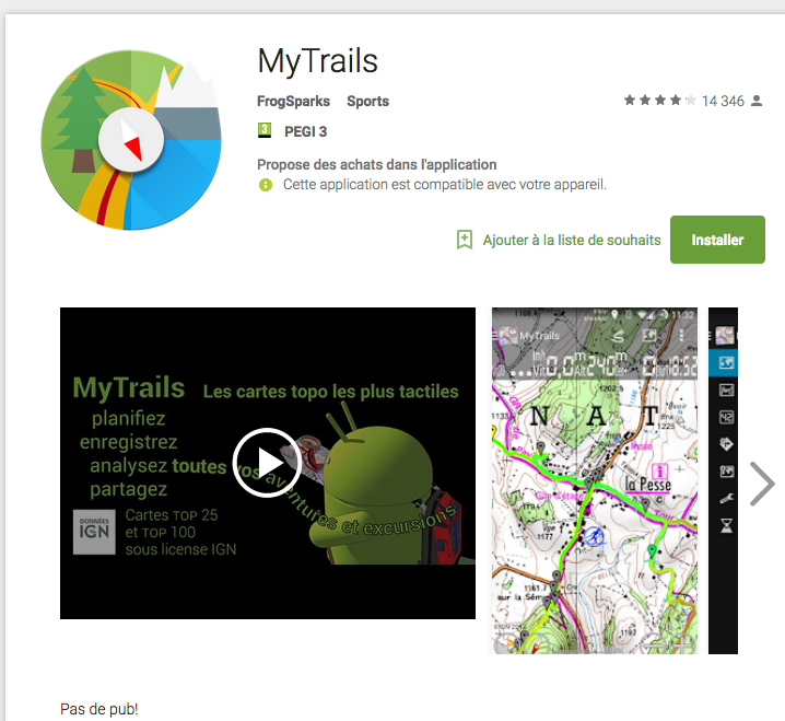 Free version with some restricted functionalities and Pro version for € 2 all unlocked features. Annual or monthly subscription Geoportal flow. € 4 to € 82.50 depending on the surface, scale and method of consultation (online / offline). The offer of « base » is 28 € (IGN TOP 25 TOP 100, Cadastre, coastline and satellite connected Unlimited + 10 000 km TOP 25 and TOP 100 offline). IOS and Android
MyTrails is only available on Android. The application aims to be as close as possible to experience a paper card by offering an intuitive interface and simple functionality. The application also has a comprehensive FAQ which facilitates handling.
Full screen map oriented with the compass and GPS: very little traffic and intuitive, she discreetly displays useful information such as the distance and duration.
Free Online Cards: ability to choose your card from a wide range (OpenStreetMap, Yahoo, Bing, Google and many other global and local sources) .You can also add new sources using configurable sources (URL or WMS server) .
Offline Maps: depending on your subscription, you can view and optionally download the IGN maps.
Registration of the course.
Customizable Alarms: Notification nearby waypoints alert you of upcoming maneuvers (vibration, ringtone and / or spoken). Waypoints: add waypoints to indicate remarkable places or intersections.Des navigation points are automatically added to the routes or when you pause. Downloading and sharing plots: ability to share and upload your tracks
 ViewRanger Gps Lafuma
Free version with Open Source mapping. Subscription 24,99 € / year or € 5.49 / month for all Geoportal data. This application includes app purchases that enhance the usability (global topographic maps …).
In partnership with Lafuma, Augmentra ViewRanger developed, application dedicated only to outdoor activities. Used worldwide, is the most downloaded app of all Geoportal compatible applications. This allows you to plan your route, store your routes and tracks or download existing route. IOS and Android
Map mode offline: ability to save your cards in advance with the « Card Backup » function.
Registration of course: ability to view your routes to keep or share.
Many statistics: Statistics distance, speed, etc.Partage your real-time location with friends: With the BuddyBeacon function Requires données.Navigation by dynamic connection: real-time display of data related to your gallery (estimate of ‘arrival time, alarms …)
 TwoNav
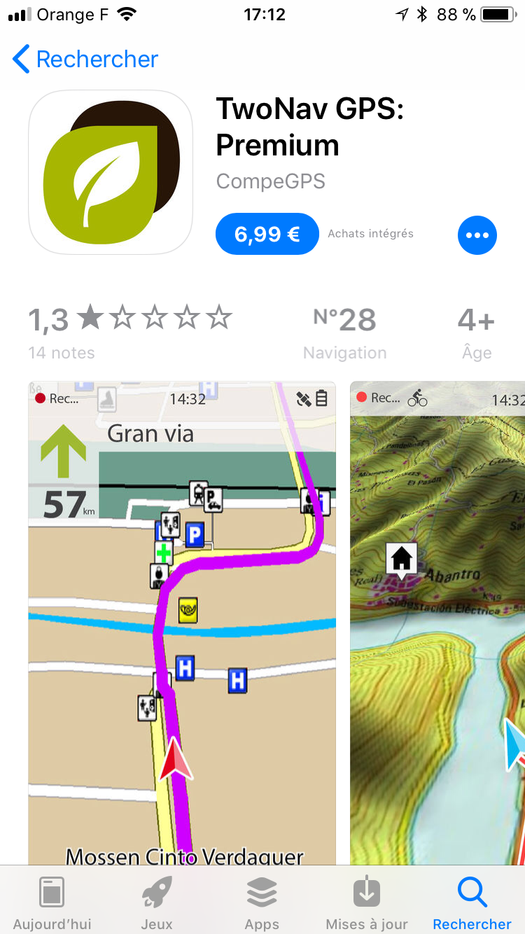
Free version with limited functions and features and Premium version of all functions to € 5.99.
Twonav is an application developed by the Spanish company CompeGPS also manufacturer of GPS. Very, complete the application offers a dual navigation system (On-Road / Off-Road) and hiking route, however, the cards are to download oneself on the Internet, or purchase in-app purchase. IOS and Android
The application also provides the ability to configure more than 60 displayable on the screen.
Tracks, routes and waypoints: ability to create an unlimited number of tracks, routes and waypoints from Land or download them from the Internet (also compatible with .gpx formats and .plt).
App purchases: opportunity to buy many topographic maps (Europe, USA, Canada). Data from the Geoportal are paying (19.99 €).
Displayable data: average speed, stopwatch, distance and estimated time to destination, altitude accumulation, maximum altitude, bedtime and sunrise …
Coupling the Land software: by connecting your smartphone to your computer, you can send or load data directly from the software data tree. The full version of this software is not free.
E-roadbooks: ability to draw your track, add pictures and comments of difficult crossings and send them to your smartphone. The smartphone is lit and triggers a beep upon arrival at a crossroads.
3D View: ability to view 3D maps.
Navigator Road: route guidance for traveling by car. TomTom mapping required (28.99 €).
 Visorando
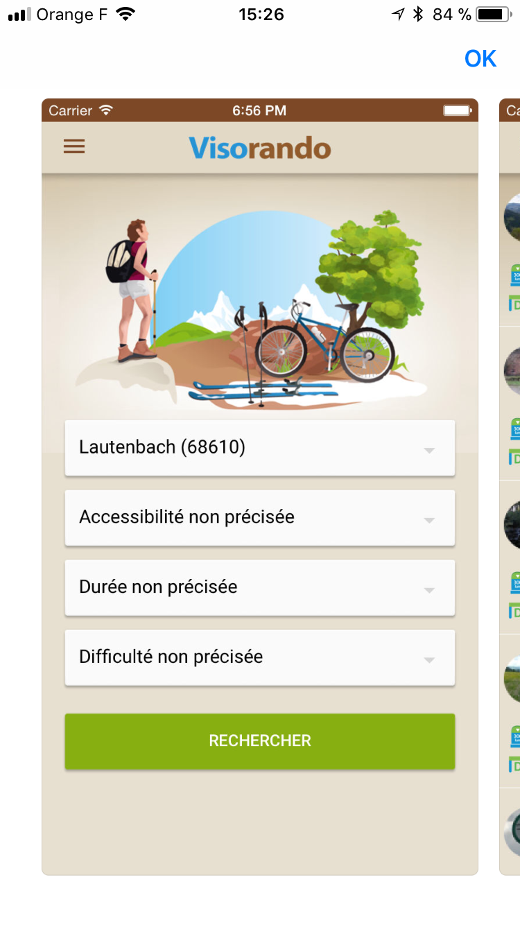
Io s
On Visorando, you can purchase a subscription to continue using the IGN maps beyond the 3 day trial period in Visorando application. This subscription allows you to view detailed maps of France in 1: 25000, cache maps (unlimited) to access even without network. Quarterly subscription to € 11.99 or € 18.99 annual subscription. (iOS only for now) The main functions
– IGN maps at 1: 25,000 in the whole of France (including overseas), even without network (caching)
– search for an idea of hiking from over 3000 selected in France (Visorando.com database)
– to favorite rides for a wireless network access.
-record your route (trace your route on GPexporter Visorando.com (ability to retrieve the GPX format or change in line with the free hiking program)
other:
-Import GPX traces through Visorando.com, import Visorando.com circuits (eg traced with hiking software), see the drawing of popular hikes or your route on the map, view your position and your bearing on the map.
Iphigenie
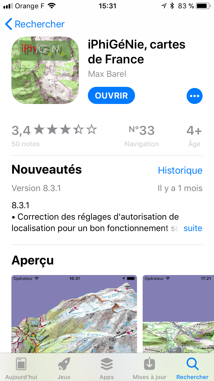 Android and iOS
A week of testing (basic) and 14.99 € / year or € 5.99 / month for all Geoportal data. This application includes app purchases that enhance the usability (ICAO data, mixed IGN / SHOM or additional modules). Most app purchases are annual subscriptions.
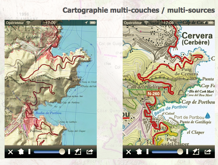
Designed in 2010, iPhiGéNie is the first application to use the offer dedicated IGN Geoportail to access data. Developed by Max Barel, it focuses hiking and tourism or leisure aviation with ICAO annual option.
Access to IGN mapping data via Geoportail: for all data Geoportal, subscription of € 14.99 / year or € 5.99 / month. Non topographic maps are freely available. Topographic maps of the IGN Spanish and ICC Catalonia and those of Norway are free on iOS only.
 Purchasing optional integrated:
– Option Cache installment: allows automated loading of layers and scales chosen in allowances set at your convenience. With a caching system, the cards are automatically retained even offline.
– Option coastal maps.
– ICAO charts option.
– Vmax option is a single purchase that unlocks all features:
– Management marks (waypoint, POI), possibly with photo: addition, classification, annotation, export-import in GPX format.
– traces of functions (routing) and roads (waypoints): Recording, manual creation, modification, monitoring (two-way), export-import.
– Automatic Sharing traces and markers via iCloud.
– Automatic downloading of maps required to follow a trail.
– Search by address or any toponym present on a map IGN. Automatic creation of associated pins.
– Function « GPS beacon »: Allows anyone you allow to see your location on a map IGN. Voluntary activation without any tracing.
– Integrated GPS Tracking tags « friends »: auto update positions. Practice during rendezvous in nature or to follow his friends.
 MemoryMap
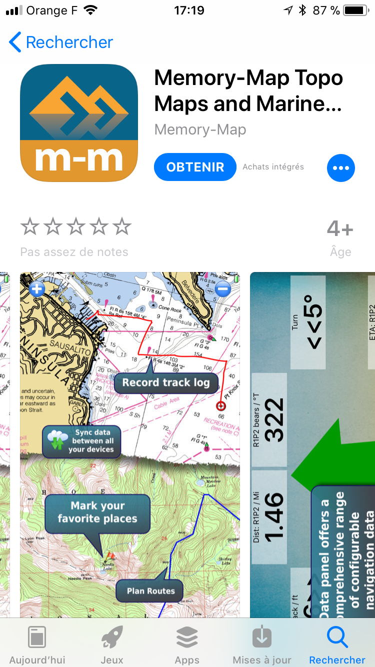
Android and iOS
Cost of Administration € 0.89. The cost of mapping IGN then varies the desired area (from € 59.99). Not compatible with Geoportal flow.
Despite its non-French translation, one of the strengths of the application based on the fact that the cards can be purchased to use a PC and then transferred to iPhone or vice versa.
Import and export GPX files: possibility to also download maps from the Memory-Map software (extra charge).
Displaying the speed and direction of travel: your speed and direction is calculated even during slow travel.
Index of names: ability to search for names.
Registration statistics and the course. Creating and editing tracks: ability to create and edit tracks directly from your smartphone. Altitude display: an altimeter displays your altitude. This is not barometric, it is possible to note the differences between the indicated altitude and reality.
 LocusMap
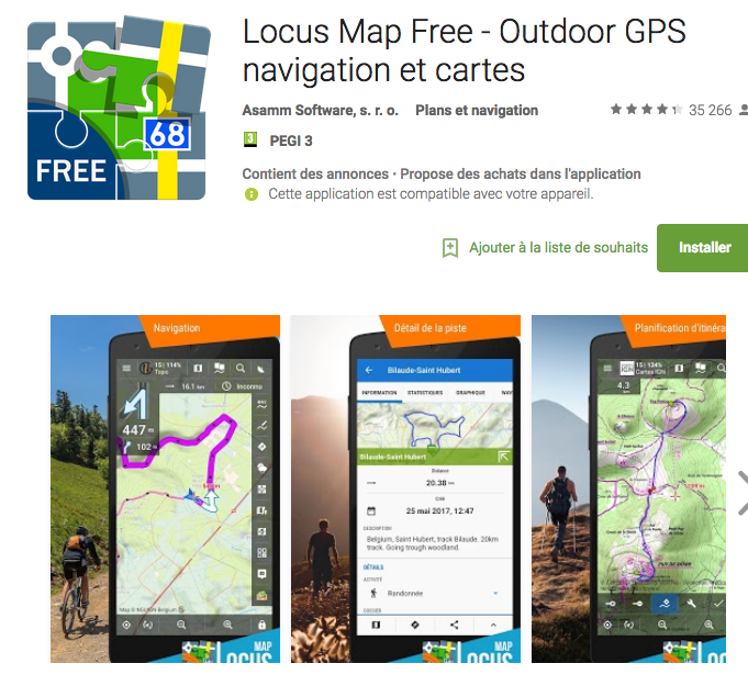
Android
GPS outdoor navigation app for hiking, treasure hunting, sports and everyday life. Download numerous types of cycling maps and hiking for offline use.
Mapping Open Source
– USGS, GSI, OpenStreetMap, MapQuest, Visicom, Kapsi.fi, Turistautak, SHOCart, SmartMaps, Freemap, SledMap, Skoterleder, Navigasi, Turaterkep, NzTopoMaps, Osmapa.pl, ChartBundle and more
– Most they can be downloaded for offline use without cellular coverage
– full WMS maps support
cards offline
– a vector maps of the city, driving, hiking, biking, skiing – downloadable by in-app billing
– the Support formats SQLite, TAR maps, MBT maps, GEMF, RMAP, Orux, SmartMaps
– Create maps from OpenStreetMap data
search
– by address, coordinates, own points, photos localized
– sites around Google Places, Wikipedia
Voice Guidance
– Full support for voice navigation Online
– Voice and guidance notification on single pass mark (compass or map) and along the way
Import / Export
– integrating GPSies, breadcrumbs, Trainingstagebuch, Street View, Google Earth and others
– Work with KML, KMZ, GPX, OpenAir, DXF formats (export)
 Outdoor France
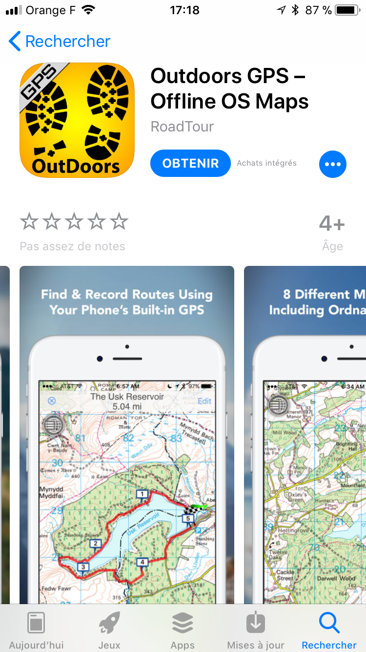
iOS
free app, € 8.99 annual subscription to IGN cartography, not compatible with the Geoportal flow.
Outdoors GPS France developed by RoadTour company is only available for iPhone and iPad. The application offers the possibility to download unlimited IGN mapping for 8.99 € (topographic maps, street maps, satellite views, reliefs and hybrids). The complementary RoadTour site is available in English only.
Changeable Interface: ability to view statistics directly from your route on the map or hide icons to display only the map.
Download unlimited cards: after the subscription contract, you can download unlimited IGN mapping. Once downloaded, maps are stored on your iPhone or iPad and can be viewed offline.
3D effect: ability to tilt some cards to get a 3D effect. Creating, editing and sharing routes. Course Finder: possibility of finding routes traced throughout France through a search engine. Graphics information: elevations, distances. Import and export GPX files.
 vtopo
vtopo
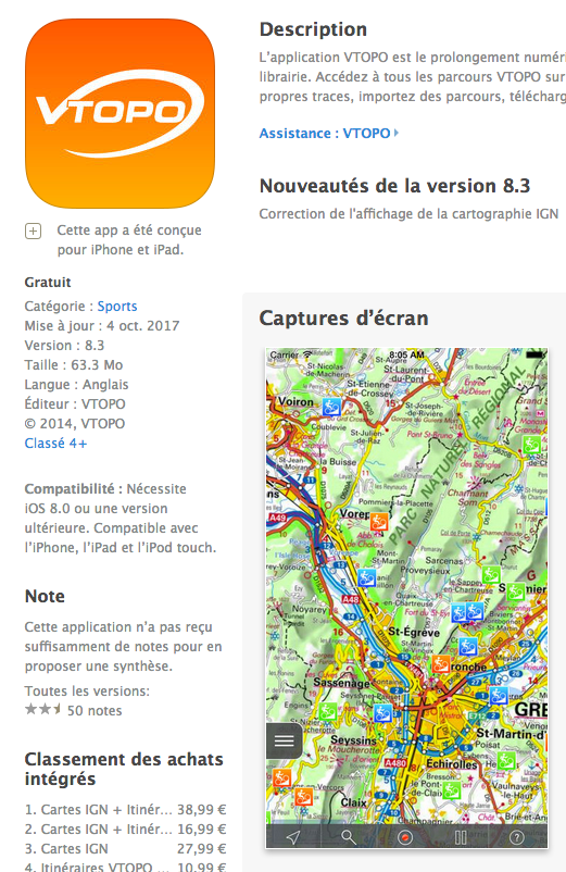
iOS. Versions for Android and Windows Mobile in development
A week trial with access to all VTOPO route and detailed maps. To access detailed maps and route VTOPO then, the application offers subscriptions integrated from 9.99 € / month or € 24.99 / year.
Developed by the company VTOPO, this recent application (on-line current 2014) does not yet have a lot of user feedback. It is the digital extension of road ATV and bike guides published by VTOPO.
Access to IGN mapping data via Geoportail.
VTOPO Course: access to over 1800 route mountain bike and road bike edited by VTOPO.
Maps and routes available in Offline Mode: ability to download map areas of France with a radius of 5 to 50 kilometers ability to download maps for several randonnées.Limite maximum of downloaded maps: 10000 km². Ability to add favorite routes to access it offline.
Recording your route, save and customize your recordings, your data management: import of GPX tracks, favorites, and records management, monitoring of downloaded detailed maps.
 MAP 3D Lite iOS
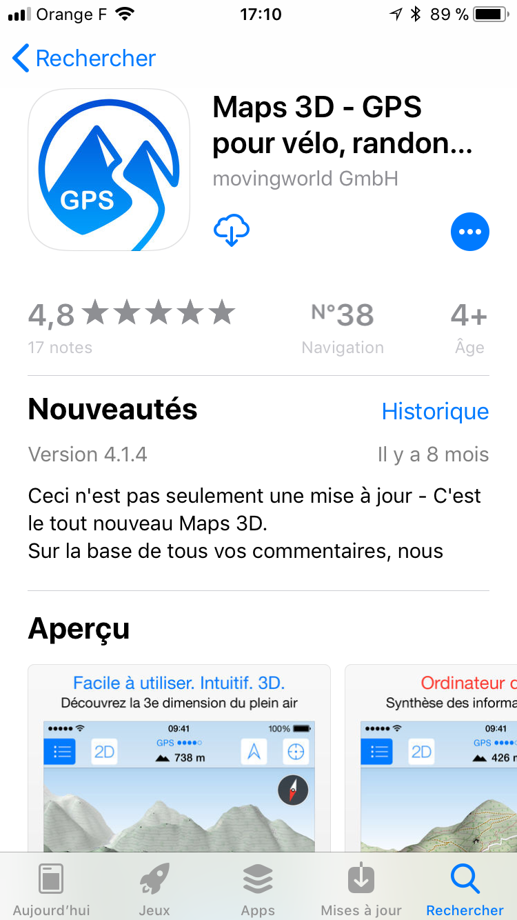
– Preload maps via Wi-Fi or 3G – and offline use network-
– backups coordinates and altitudes tracks
– recording the information on your route with altitude and speed profiles
– Search of places, roads, mountains, lakes and other points of interest including offline
– the exact terrain maps based on scans of the Earth’s surface by NASA (realistic 3D rendering in all perspectives, ridge lines in the topographic map
– Loading easily routes via iTunes, Everytrail, email, URL or Dropbox
– Display the distance, the current average speed and altitude
– Export trips: just email
– Free OSM maps with bicycle routes, hiking, horseback riding, cross country and downhill skiing
– Three different scales
– Sharing the position and link to a map on Twitter and Facebook
– Maps for the world
– the Pro version to 4.99 € you will download 20 times larger maps and save an unlimited number of course
 Quechua trekking
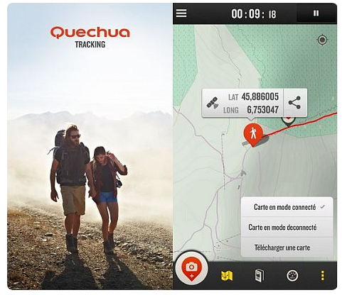
With its collaborative card background OpenStreetMap, Landscape, application allows to know its GPS location in real time and around the world. Here we find a graphic design oriented to the outdoors with suitable colors, levels of curves, the presence of many terrain features. Side scale: 1 / 100,000th. Aie..Un little low for our tastes when it comes to know its precise position … Finally, if you walk in a sector weakling network, it will be possible to download a pre-base map, with 1.99 €
– business visibility and performance: altitude, elevation profile and accumulation, distance, climb rate, running time ..
– ability to create a book of original and attractive touring with his photos, recounting his experience he can then share with friends the HikeBook, that is to say, a new generation hiking book that will shape your most beautiful memories. The principle of photos and reviews associated with your route, complemented by basic information: points of departure and arrival, altitude, time, speed … what you see, improvise author topographical maps of modern times.
Summary compatibility Ios, Android and Geoportal flow
Advertising
